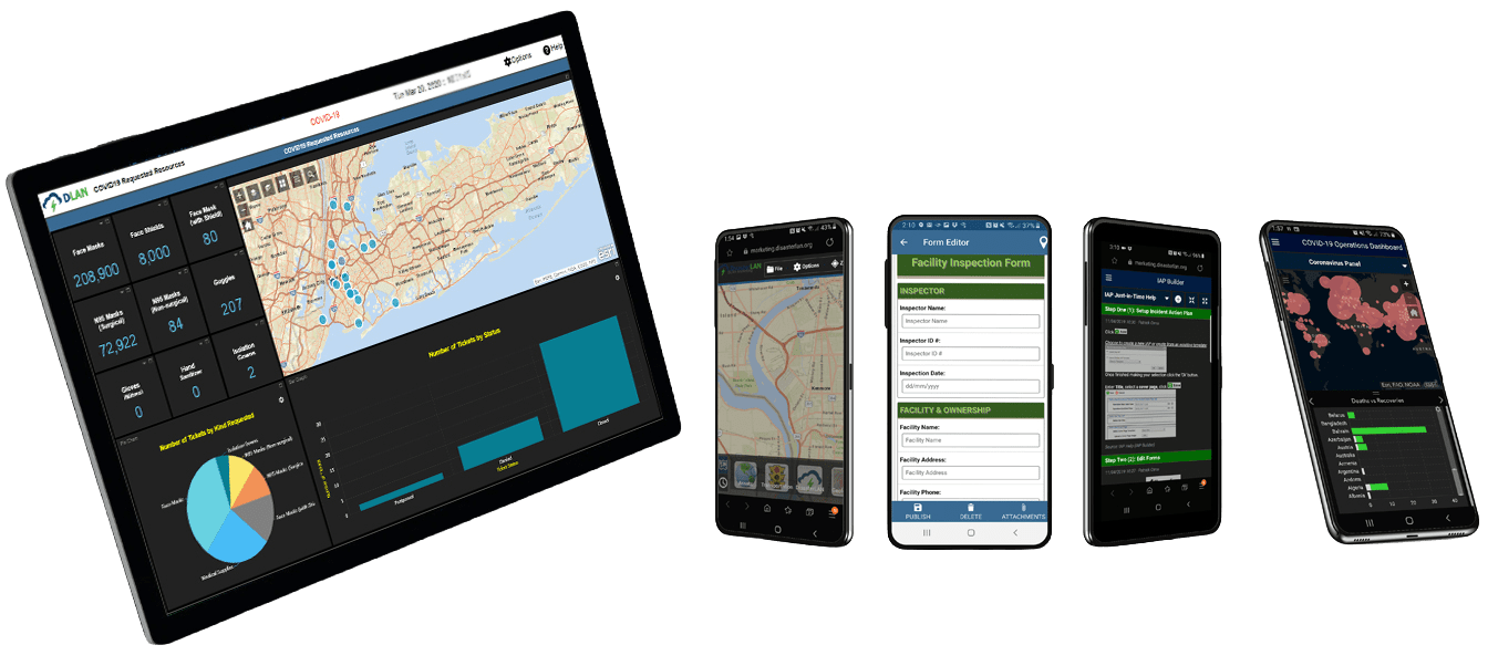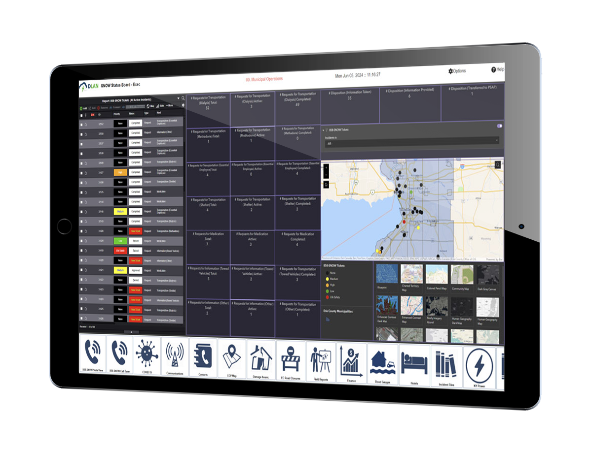
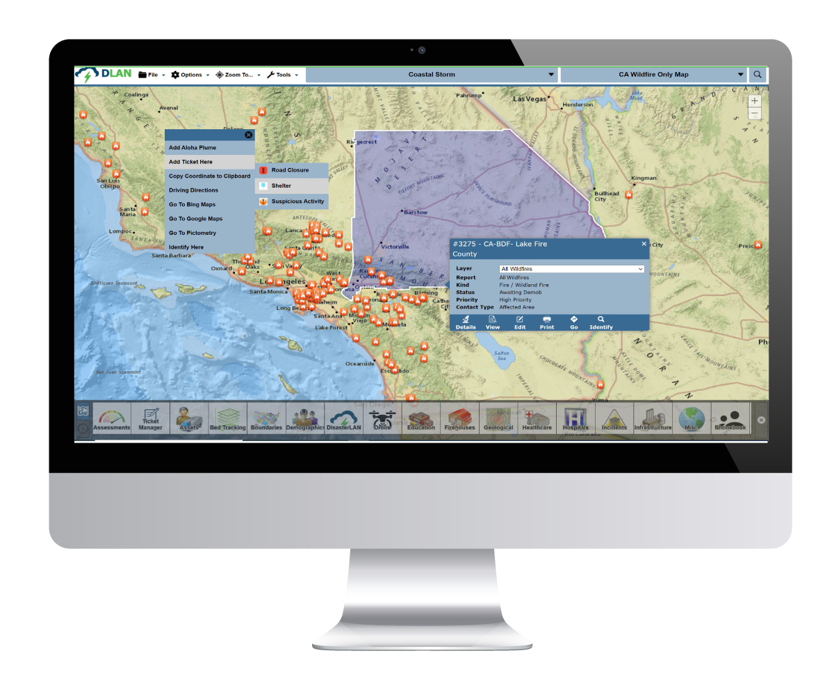
Situational Awareness & GIS Mapping
See what’s happening — and where.
Visualize incidents, assets, weather, and critical infrastructure on a single live map.
Key Features
- ESRI-based GIS integration
- Custom overlays for hazards, shelters, and critical facilities
- Live data feeds from sensors and external systems
- Real-time updates shared across agencies
In Practice: Agencies overlay plume models, flood zones, and infrastructure data during exercises and live events to guide response decisions.