What Is ECDIS and Why Electronic Charting Matters for Modern Vessels
Nov. 3rd, 2026 12:00 pm
Paper charts served mariners for centuries, yet today's busy waterways demand faster, smarter navigation tools on the bridge. An Electronic Chart Display and Information System (ECDIS) brings charts, position, and sensor data together on one screen. For your officers, that combined view supports safer decisions during every watch, from open ocean to tight harbors.
In this article, you will learn how ECDIS works and why electronic charting matters across today's fleets. You will also see how simulation training helps mariners master the system before they rely on it at sea. Every insight applies whether you lead a maritime academy, a commercial training center, or a vessel operator.
What Is an Electronic Chart Display and Information System?
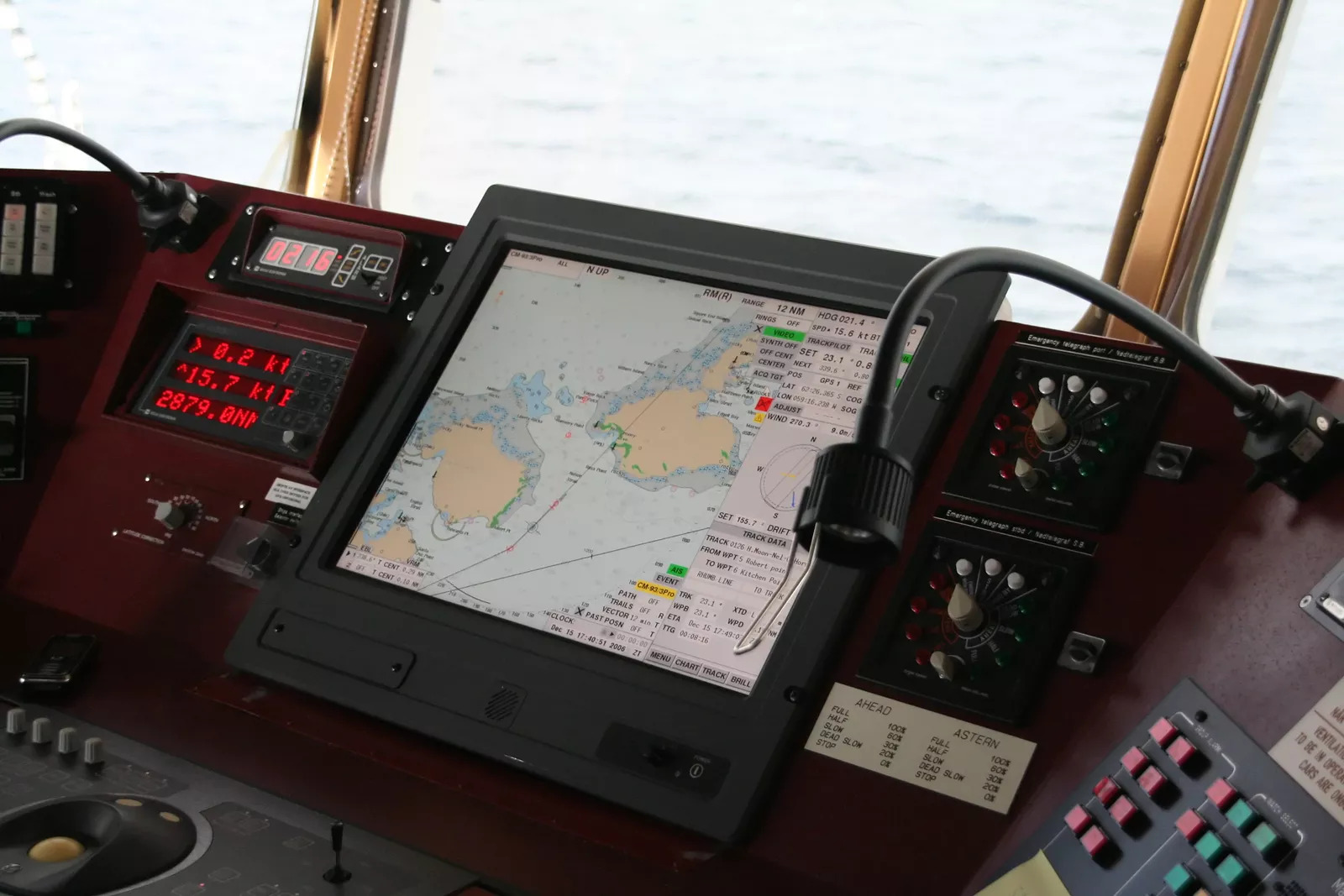
An electronic chart display and information system is a navigation system that displays official electronic charts with live ship data. It combines Global Positioning System (GPS), radar, AIS, and other sensor inputs to show position, route, and nearby hazards. When it meets international standards, ECDIS can replace paper charts as a vessel's primary means of navigation.
How an Electronic Chart Display and Information System Works
At its core, ECDIS pairs official chart data with real-time inputs from the ship's navigation sensors. Every electronic chart display and information system relies on Electronic Navigational Charts (ENCs) produced by national hydrographic offices. According to the National Oceanic and Atmospheric Administration (NOAA), ENCs support real-time positioning plus collision and grounding avoidance.
First, the system plots your position from satellite GPS data and updates it continuously as the vessel moves. Next, it overlays radar targets and Automatic Identification System (AIS) data, showing nearby traffic directly on the chart. Then, it compares your planned route against depths, hazards, and boundaries, sounding alarms when danger approaches.
Officers can also build voyage plans digitally, checking each leg for shallow water and restricted areas. Chart corrections arrive electronically as well, replacing hours of manual updates with paper charts and pencils.
According to the International Hydrographic Organization (IHO), an ECDIS meeting carriage rules must be type-approved and use current ENCs. It also needs an independent backup arrangement, so a single failure never leaves the bridge without charts. As a result, crews must understand both the primary system and the backup procedures behind it.
Why Electronic Charting Matters for Modern Vessels
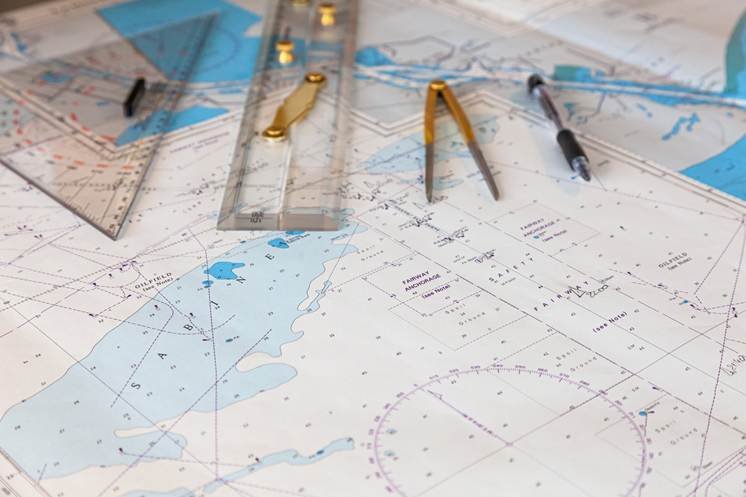
Electronic charting has evolved from an alternative to paper charts into a core part of safe, modern navigation. According to the International Maritime Organization (IMO), mandatory ECDIS carriage began phasing in for ships in 2011. An electronic chart display and information system delivers several advantages that paper charts cannot match.
-
Real-time awareness: Position, heading, traffic, and hazards appear together, giving officers a complete situational picture on a single screen.
-
Automated alarms: Warnings for shallow water, off-track drift, and restricted zones help crews act before trouble develops.
-
Faster voyage planning: Digital route tools check each leg against chart data instead of relying on manual plotting.
-
Current chart data: Electronic updates keep charts accurate without hours of hand corrections during busy port stays.
In practice, the advantages reduce workload so officers spend more time watching the water and less time plotting. Still, technology alone cannot prevent accidents when crews misread displays or trust alarms without verifying them. Strong bridge habits pair ECDIS information with visual lookout, radar checks, and sound seamanship.
Similarly, alarm fatigue becomes a real risk when officers silence frequent warnings without checking the cause. Proper configuration and training keep alerts meaningful, so crews respond quickly when a warning matters.
Meanwhile, shipping companies need officers who can step onto any bridge and use its charting system confidently. While fundamental ECDIS operating principles are consistent across manufacturers, individual systems differ in their controls, menus, and functionality. Consequently, training programs must prepare mariners for the systems they will meet across their careers.
Training Crews on an Electronic Chart Display and Information System
Hands-on practice turns ECDIS knowledge into confident action when conditions change quickly on the bridge. Simulation lets your trainees operate an electronic chart display and information system safely, without risking a real vessel. Instructors can then introduce sensor failures, heavy traffic, and route hazards that test every decision.
Buffalo Computer Graphics (BCG) offers ECDIS and electronic chart system stimulation capabilities that feed realistic ship sensor data into training displays. Trainees then see positions, targets, and alarms behave just as they would during a real voyage. BCG supports a wide range of ECDIS manufacturers allowing for better flexibility in training.
Next, connect charting practice with a radar overlay ( radar simulation ) so students learn to cross-check every target. Our AIS simulation adds realistic vessel traffic, helping trainees match chart symbols with radar returns. Additionally, instructor control software lets your team adjust scenarios and monitor each student in real time.

Imagine a trainee planning a coastal passage who misses a shallow patch near the final approach. Because the error happens in a simulator, the instructor lets the grounding alarm sound and pauses the exercise. Afterward, the debrief shows exactly where the route check failed and how to catch it next time.
Finally, revisit charting skills throughout the program so trainees build lasting habits, not one-time knowledge. Regular practice keeps future officers ready for any bridge, any route, and any charting system.
Build Confident Bridge Teams With Realistic Charting Practice
An electronic chart display and information system gives modern vessels a clearer, faster, and safer view of their surroundings. Still, its value depends on officers who understand the system, question its alarms, and verify its data. Realistic simulation builds that understanding long before your trainees take charge of a real watch.
At BCG, our Buffalo engineers have designed maritime simulation solutions in-house for training facilities since 1982. You gain responsive support, transparent terms with no hidden costs, and tools built around your curriculum. Reach out to our simulation specialists to bring realistic ECDIS training into your classroom.

