Case Study: DLAN Helps Ventura County Office of Emergency Services Simplify Public Notifications
The VCEM Emergency Website was designed to be a single central place to direct people to during an emergency. Along with text based notifications, the site includes an interactive incident map powered by ESRI’s ArcGIS Online. Ventura County OES setup their DLAN system to directly feed information about shelter locations and road closures into the interactive map. This means that no one on Ventura’s team needs to login to the map to update this information and share it with the public, it is all done automatically through DLAN’s Ticket Manager and ArcGIS Online mapping tools. The system was successfully utilized in late 2018 for the Woolsey Fire to let the public know about road closures and shelter locations.
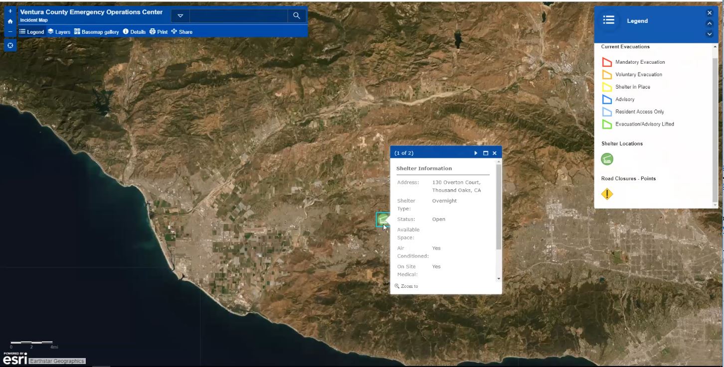
VCEM Emergency Website - Incident Map
