DLAN’s GIS Premium Integrated Traffic Monitoring Enhances Situational Awareness
DLAN’s GIS Premium module now provides fully integrated world-wide live traffic monitoring for improved situational awareness. These services are included free of charge for all DLAN GIS Premium customers.
Powered by the ESRI World Traffic Map, DLAN is able to offer historical, live, and predictive traffic feeds that incorporate real-time HERETM traffic layers on interactive DLAN maps. With these tools, DLAN users can display current traffic issues that are impacting the flow of traffic, such as accidents, construction, and lane closures. These tools also allow DLAN users to easily visualize real-time traffic speeds on any GIS Map or Map Report in the system. When combined with other DLAN map layers, these premium traffic analysis features allow us to provide our customers with the best situational awareness toolset on the market.
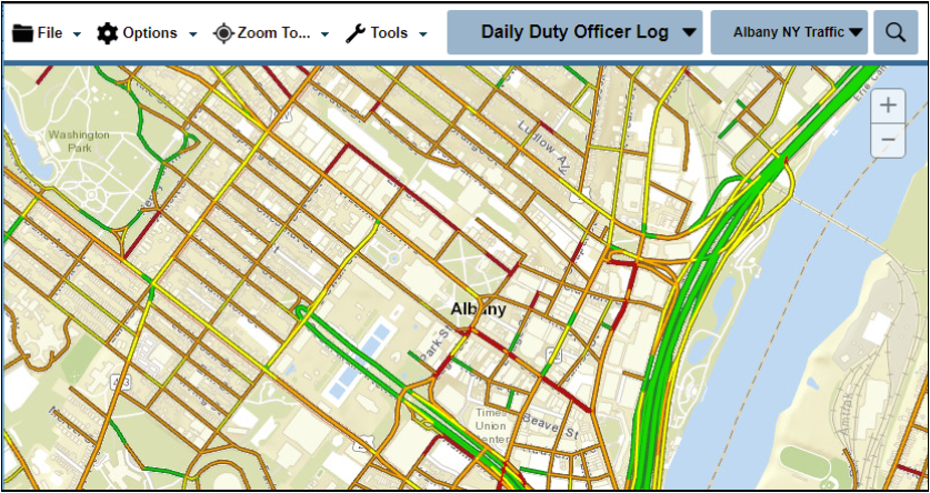
GIS Premium - Traffic
Real-time traffic data is only one example of the many feeds that can be incorporated into GIS Premium free of charge. Other feeds include Aeris Weather, AVL Trackers, Mesonet Services, and many premium ESRI ArcGIS Server or ArcGIS Online services. Additionally, GIS Premium supports the display of data from most common GIS formats out-of-the-box and unlike other solutions that require costly per-user accounts, DLAN's GIS is accessible to all your DLAN users with no hidden usage fees.
In addition to our great analysis tools in GIS Premium, we have also improved our Route Analysis module. Route Analysis extends these traffic services to provide monitoring and advanced warning for conditions that might impact critical routes your organization depends upon. The module allows organizations to monitor conditions such as severe weather and safety thresholds that could impact shipments across important routes, such as temperature, wind speed, and humidity. Once configured to your specific routes and requirements, DLAN uses predictive information from multiple weather databases to help determine if your critical routes will remain safe in the near future. In addition to generating map layers that display forecast dangers along the route, automated alerts can be emailed to users when a route falls within conditions that would put it at risk. This great service is available as an add-on to DLAN systems and is designed to tightly integrate into our GIS Premium module.
